BUY IT ONCE. USE IT FOREVER.

5 REASONS WHY THIS IS THE LAST NAVIGATION TOOL YOU'LL EVER NEED TO BUY

β˜…β˜…β˜…β˜…β˜…

4.8 Stars β€” 10,000+ Verified Reviews

Traveler comparing a failed phone route with the MapBound atlas inside a parked car

Reason 01

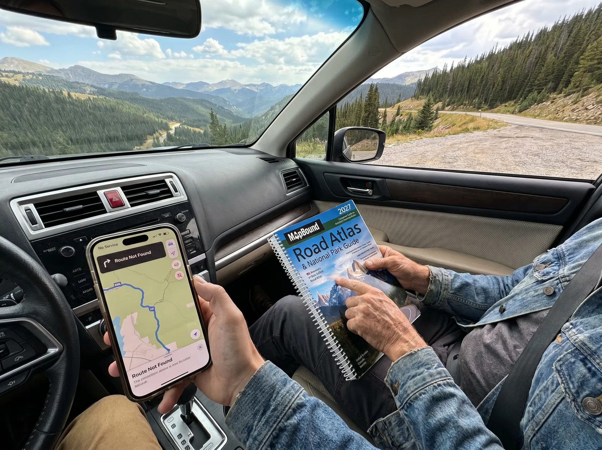
EVERY OTHER NAVIGATION TOOL HAS A SUBSCRIPTION, AN EXPIRY DATE, OR A FAILURE POINT. THIS HAS NONE.

Think about every navigation tool you currently use. Your phone plan has a monthly fee. Your mapping app has a premium tier or sells your data. Your downloaded maps expire or get locked behind logins. Your GPS unit needs firmware updates and eventually becomes obsolete. Every digital navigation tool you own has an ongoing cost, a dependency, or a point at which it stops working.

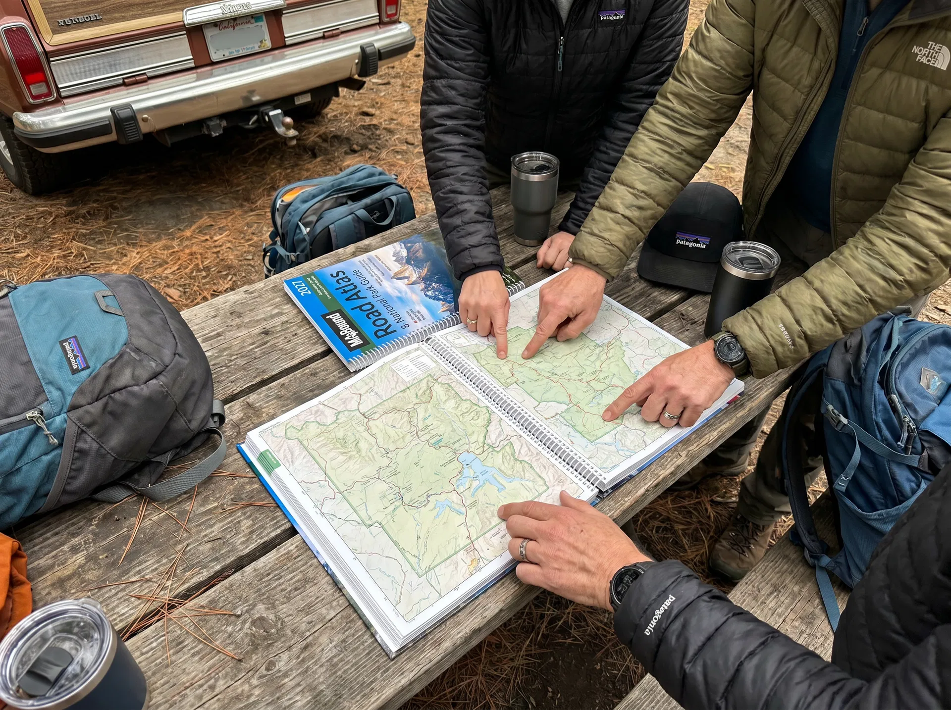
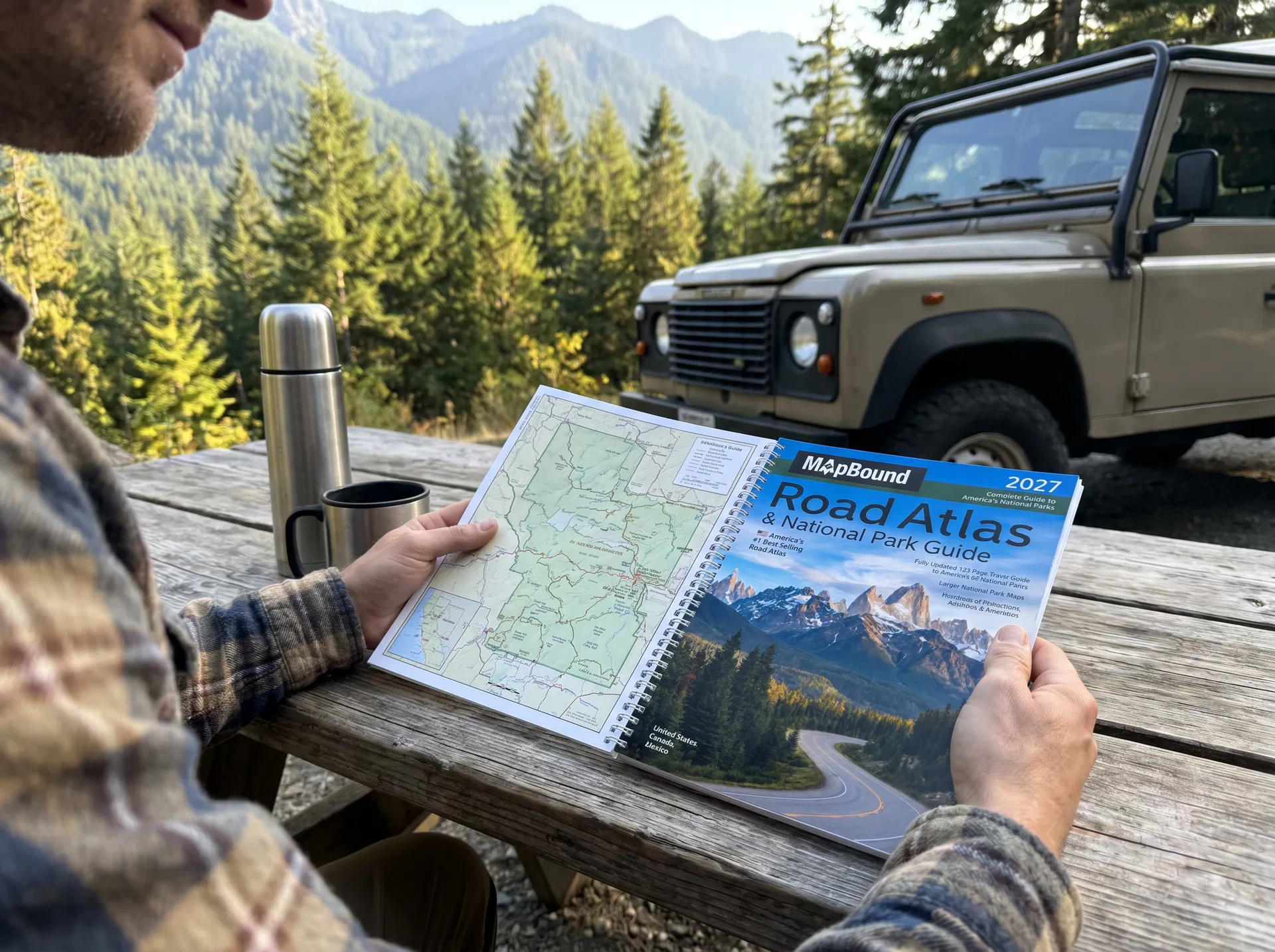
The MapBound Road Atlas 2027 has none of those things. You buy it once. It works from the moment it arrives until the day you decide to buy the next year's edition. No subscription. No login. No battery. No signal. No update required. No planned obsolescence.

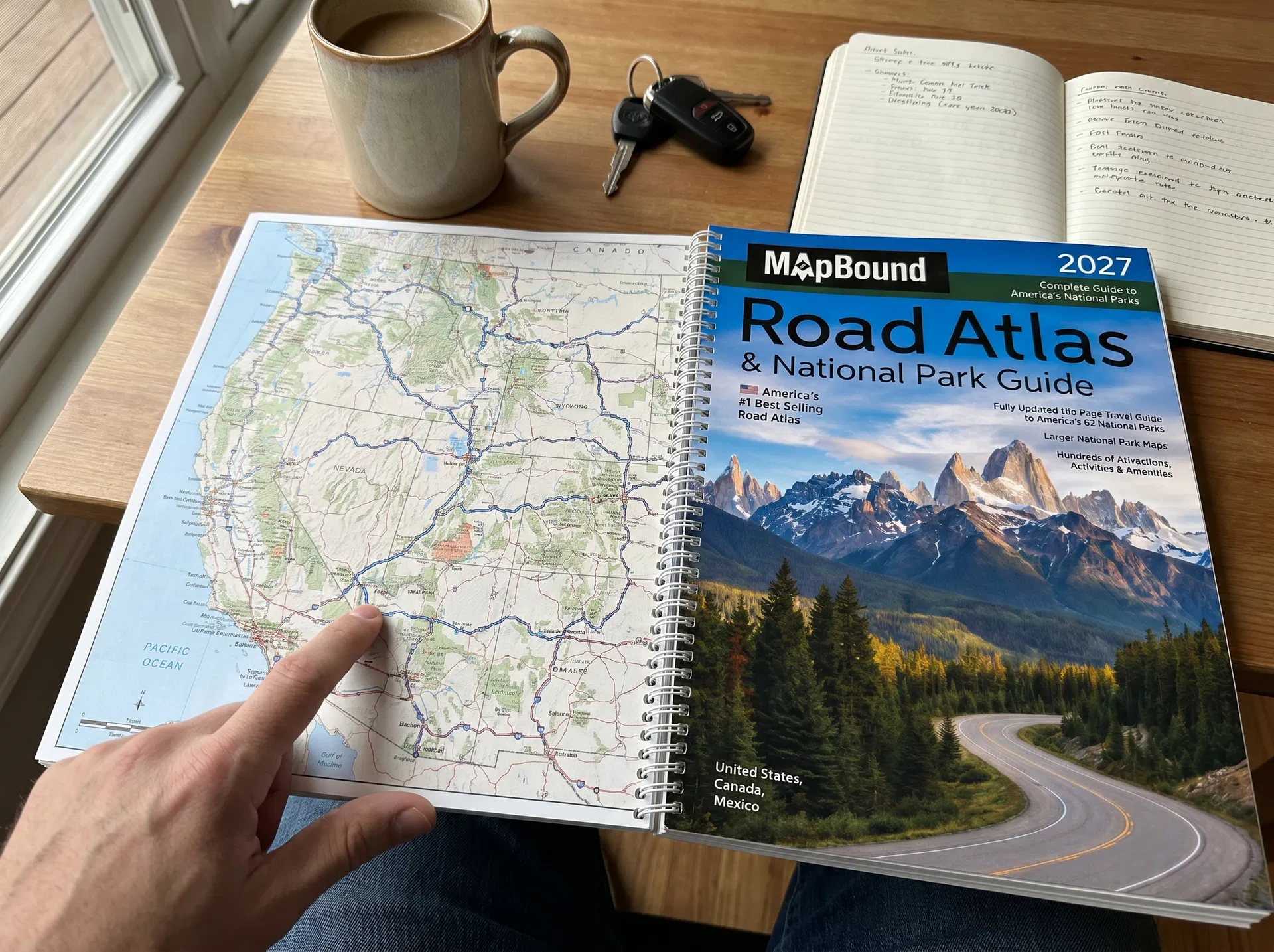
274 pages. All 50 states. All 63 National Parks. 378 city insets. Canada. Mexico. Updated annually by a real U.S. cartography team. Yours completely. Forever. That's what a one-time purchase that never asks for anything else looks like.

β˜…β˜…β˜…β˜…β˜…

No Subscription. No Nonsense.

β€œI've spent more on navigation app subscriptions in the last three years than I've spent on atlases in my entire life. And the apps have failed me more times than I can count. This has never failed me once. The math is not complicated.”

ReviewerChris M., Montana

Reason 02

THERE IS NO SETUP. NO ACCOUNT. NO DOWNLOAD. YOU OPEN IT AND IT WORKS.

Before you can use almost any digital navigation tool, there is a process. Download the app. Create an account. Verify your email. Allow location access. Enable notifications. Subscribe to the premium tier to unlock offline maps. Download the offline maps. Wait for the download. Hope the app doesn't require a re-login before you need them.

The MapBound Road Atlas 2027 has no process. You open the cover. You find your state. You use it. That's everything. There is no step between receiving it and using it β€” no app store, no account creation, no permissions, no loading screen, no subscription prompt.

For the one-time buyer who wants a navigation tool that works immediately and always β€” this is the only option that delivers that completely. From the moment it arrives to the last mile of the last trip you ever take.

β˜…β˜…β˜…β˜…β˜…

Open and Use. That's It.

β€œI'm so tired of apps that need updates and logins and subscriptions just to show me a map. This thing β€” open it, use it, done. That's all I wanted. That's exactly what this is. I don't know why I waited so long.”

ReviewerLaura B., Arizona
Traveler opening and using the MapBound atlas immediately during trip planning
MapBound atlas open across a lap with a route being traced during trip planning

Reason 03

IT WORKS IN THE 30% OF AMERICA WHERE EVERYTHING ELSE DOESN'T.

Cell towers cover roughly 70% of the United States by land area. The remaining 30% β€” nearly a million square miles β€” has no coverage at all. That 30% includes the majority of America's National Parks, most of the American West, and virtually every remote road trip destination people drive to specifically because it's wild and far from everything.

Every digital navigation tool fails in that 30%. GPS apps lose their maps. Downloaded content locks behind logins. Batteries drain faster because cellular radios work overtime searching for towers that don't exist. Premium subscriptions become irrelevant because the subscription doesn't cover physics.

The MapBound Road Atlas 2027 covers that entire 30% with the same detail it covers downtown Los Angeles. No signal required. No exceptions. 274 pages that work in every dead zone on the continent β€” which is exactly why it's the last navigation tool you'll ever need to buy.

β˜…β˜…β˜…β˜…β˜…

Works Where Nothing Else Does

β€œI've been through enough National Park dead zones to know that no app, no matter how premium, works without signal. This atlas works everywhere. It's the only navigation tool I've never had to apologize for relying on.”

ReviewerBrian T., Utah

Reason 04

IT WORKS FOR EVERY PERSON IN THE CAR. EVERY AGE. EVERY TRIP. EVERY TIME.

Digital navigation tools have a generational problem. Elderly passengers can't read a 6-inch phone screen at highway speed. Young children can't interact with an app. Teenagers disengage from turn-by-turn directions that give them nothing to engage with. The driver stares at the phone. Everyone else stares at their own.

A road atlas works for everyone in the car simultaneously. The grandparent who grew up with maps reads it naturally. The child traces the route with their finger and asks questions. The teenager tracks the states and circles the parks. The driver glances at it instead of a screen. Everyone is navigating together.

The MapBound Road Atlas 2027 β€” large enough to read from the back seat, detailed enough to answer every question, physical enough that three generations can lean over it together. One tool. Every passenger. Every trip.

β˜…β˜…β˜…β˜…β˜…

Works for Everyone in the Car

β€œMy 8-year-old and my 70-year-old father-in-law are both obsessed with this atlas on road trips. Neither of them can really use the GPS app. Both of them can use this. That alone makes it the best navigation tool we have.”

ReviewerJennifer M., Ohio
Travel companions gathered around the MapBound atlas at a roadside stop
Traveler using the MapBound atlas at a scenic roadside table before continuing the drive

Reason 05

OVER 100 YEARS OF CARTOGRAPHY BEHIND IT. UPDATED EVERY YEAR. NEVER OBSOLETE.

MapBound is built around the same enduring principle that has kept printed navigation useful for generations: real cartography, annual updates, and a product you can trust every time you hit the road. Navigation tools come and go. A well-made atlas remains useful because it is designed to be physically owned, referenced quickly, and upgraded only when you choose.

The 2027 edition is updated by an in-house U.S. cartography team β€” capturing road changes, improved national park information, route context, and current infrastructure. It is the most up-to-date printed road atlas you can buy for this style of trip.

And when the next edition arrives, you can upgrade on your terms. Until then, the copy you buy today works completely from the first day you open it to the last trip you take with it. This isn't a product that becomes obsolete after checkout. It's a system that stays useful because it was designed to work without dependence.

β˜…β˜…β˜…β˜…β˜…

The Last Navigation Tool I'll Ever Need

β€œI've bought every navigation technology since the 90s. GPS units, phone mounts, premium apps, satellite communicators. This atlas has outlasted every single one and cost less than any of them. It's the last navigation tool I'll ever buy. I mean that.”

ReviewerMark D., Idaho

BUY IT ONCE. USE IT FOREVER. NEVER WORRY ABOUT NAVIGATION AGAIN.

Every other tool asks for more. More money. More battery. More signal. More logins. More updates. More subscriptions. More everything. The MapBound Road Atlas 2027 asks for nothing after you buy it. No signal. No battery. No account. No renewal. It just works β€” in every state, every National Park, every dead zone on the continent β€” from the first trip to the last. That's what the last navigation tool you'll ever need to buy actually looks like.

THE LAST NAVIGATION TOOL YOU'LL EVER NEED

ROAD ATLAS & NATIONAL PARK GUIDE 2027

United States, Canada & Mexico β€” Works Without Signal. Updated for 2027. All 63 National Parks.

MapBound atlas cover from the Shopify product gallery
$99.99 Only $49.99
β˜…β˜…β˜…β˜…β˜…

4.8 Stars β€” 10,000+ Verified Reviews

Road Atlas & National Park Guide 2027. United States, Canada & Mexico. Works Without Signal. Updated for 2027. All 63 National Parks.

Spiral-Bound 274 Pages
GET THE ATLAS β†’
MapBound road atlas cover
Road Atlas & National Park Guide 2027
$99.99$49.99
πŸ›’ Get the Atlas