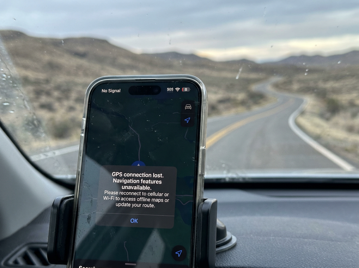
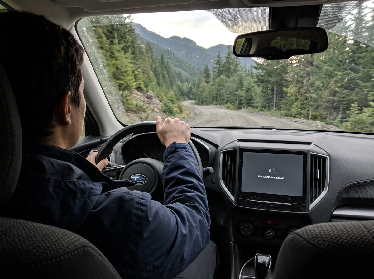
IT DOESN'T WARN YOU. IT JUST STOPS.
4.8 Stars — 10,000+ Verified Reviews

THE FAILURE
There's a specific thing people say about GPS failure that isn't true. They say it gets spotty first. That you get warnings. That you have time to prepare.
You don't. GPS doesn't fail gradually. One moment the blue arrow is moving, the ETA is counting down, the route is clear. And then — instantly — the screen is blank. The signal is gone. The app tries to reroute with no data to pull from. And you're on a road you've never driven with no idea what's ahead.
That's what "fails all at once" actually looks like. No warning. No gradual degradation. Just the sudden, complete absence of the only navigation tool in the car. The drivers who prepared for this before they left don't panic. The ones who didn't have no next move.
No Warning. Just Gone.
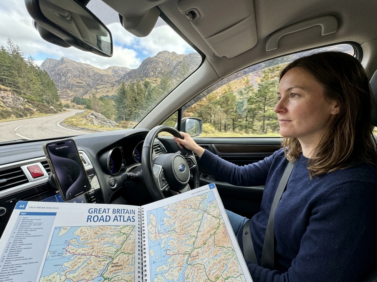
“GPS died entering Glacier. Not slow, not spotty — just gone. One second it was working, next second blank screen. I had nothing else. Sat there for twenty minutes. Atlas has been under the seat on every trip since that day.”
WHY IT'S TOTAL
Most people think GPS failure is just a signal problem. It isn't. It's three failures happening simultaneously — triggered by the same conditions, in the same places, at the same time.
Signal disappears first — because cell towers don't exist in National Parks, mountain passes, and remote corridors. Then battery dies — because the cellular radio works hardest searching for towers that aren't there, draining three times faster than normal. Then the offline maps lock — because major navigation apps require a cloud login to access downloaded content, and that login needs the internet that just disappeared.
Three failure points. All at once. In the most remote places on the drive. The atlas has none of those failure points. No signal. No battery. No login. 274 pages. Open it. It works. That's the entire difference.
All Three at the Same Time
“Battery gone, signal gone, offline maps behind a login I couldn't open. All three simultaneously, forty miles from the nearest town. I didn't even know that was possible until it happened to me. The atlas doesn't have any of those problems.”


THE DIFFERENCE
This is the moment that separates two kinds of road trippers. GPS dies. Screen goes blank. Signal is gone.
One driver reaches under the seat. Opens 274 pages of signal-free, battery-free, login-free navigation. Finds their location. Traces the route forward. Keeps driving.
The other driver pulls over. Waits. Holds the phone up in different directions searching for a bar that isn't there. Has no next move. The difference isn't skill or experience or a better phone. It's one physical object under the seat that was placed there before the trip. Thirty seconds of preparation. The atlas covers all 63 National Parks, every state, 378 city insets, Canada and Mexico — working in every dead zone where GPS just failed.
Kept Moving When GPS Quit
“There were two cars pulled over in the same dead zone in Yellowstone waiting for signal. We drove past them. Atlas open, knew exactly where we were. That image — those cars pulled over, us moving — is why I never drive without it.”
INSIDE THE PARKS
GPS fails most reliably in the places most road trips are going. National Parks are among the most cell-coverage-poor environments in America — protected wilderness where tower construction is restricted, terrain where signal propagation is limited by the same geography that makes the views spectacular.
Yellowstone: patchy to no coverage across most of the interior. Glacier: dead zones for significant stretches of the Going-to-the-Sun Road. Grand Canyon: minimal coverage inside the canyon. Death Valley: vast sections with zero bars. Great Smoky Mountains: frequent dead zones through the mountain corridor.
These are the five most visited National Parks in America. The atlas dedicates 2 to 4 pages to each one — trail maps, lodging, best times, weather, key attractions. 133 pages total across all 63 parks. When GPS fails all at once at the entrance gate, the atlas is already open.
Three Days Without GPS. Zero Problems.
“GPS died at the Yellowstone entrance. Used the atlas for three full days inside the park. Navigated every trail, every campsite, every viewpoint. Never once felt lost. The atlas had everything. I don't know what the other visitors did.”


THE PREPARATION
This is the entire preparation. Thirty seconds. Before the drive. Before the highway. Before the National Park and the dead zone and the blank screen.
You put the atlas under the seat. You forget it's there. You drive thousands of miles with GPS working perfectly. And then one specific day, in one specific place — the screen goes blank, all at once, no warning — and you reach under the seat.
274 pages. All 63 National Parks. 378 city insets. Every state. Canada. Mexico. No battery. No signal. No login. No subscription. Right there. Exactly when GPS failed all at once. That's what "prepared" actually looks like. Not a better app. Not a premium subscription. Thirty seconds. Under the seat. Done.
Thirty Seconds Changed Everything
“I put this under the seat before every road trip now. Takes thirty seconds. GPS has failed me twice since. Both times I reached under the seat and kept driving. That's the whole system. Thirty seconds of prep. Zero problems after.”
GPS DOESN'T WARN YOU. THE ATLAS DOESN'T NEED TO.
Every GPS failure happens the same way. One moment working. Next moment blank. No warning. No gradual decline. Just the sudden, complete absence of the only navigation tool in the car. The drivers who prepared for this before they left reach under the seat and keep moving. The drivers who didn't pull over and wait. Thirty seconds of preparation. One atlas under the seat. That's the entire difference between those two drivers.
THE BACKUP THAT WORKS WHEN GPS DOESN'T
United States, Canada & Mexico — Works Without Signal. Updated for 2027. All 63 National Parks.
4.8 Stars — 10,000+ Verified Reviews
Road Atlas & National Park Guide 2027. United States, Canada & Mexico. Works Without Signal. Updated for 2027. All 63 National Parks.